
Who wants to see a giant waterfall that has no water in it? Oo oo sign Cobalt and Potassium up! That’s right, we drove two hours away to see the grave of an ancient waterfall!
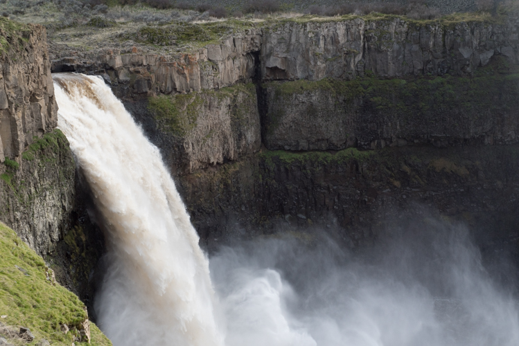
This week’s post is a continuation of Cobalt’s and my exploration of how floods from thousands of years ago carved out the landscape of eastern Washington state. A few weeks ago, we went to see Palouse Falls, and then the next weekend we headed farther north to see its cousin, Dry Falls.
During the end of the last ice age, Dry Falls was apparently the largest waterfall in the world at 3.5 miles wide and 400 feet tall! That’s like five times the width of all three falls that make up Niagara Falls. And the tallest of the Niagara Falls is less than 200 feet. So… Dry Falls was friggin’ HUGE. Tons of water surged over these now-dry cliffs as it made its way toward the sea. And now it’s all gone. The only thing that remains are the cliffs themselves and those ponds, called “plunge pools,” where the cascading water carved out the rock below. But it must have been quite a sight!
I took this picture from the visitor center, which sits at the top of Dry Falls. The whole time we were up there, I was itching to get down to the bottom. I wanted to be surrounded by these huge cliffs and imagine what it would have been like to be completely underwater.
It turns out that there’s a trail that takes you to the edge of that plunge pool on the left in that picture, and it wasn’t too cold out. So Cobalt, our friend K and I had a wonderful walk across the floor of the former riverbed. It also turns out that it’s really hard to photograph just how crazy and awe-inspiring it felt to be surrounded by walls of rock that used to be a waterfall. But I’ll try:


Utter craziness, I say. Stay tuned for more fun with ice age floods as Cobalt’s and my exploring continues. Are you from the area? Where should we go next? We’re always on the lookout for our next adventure. :)